File:Groddle Heights Map.png
Revision as of 08:29, 22 May 2019 by Mndarrr (talk | contribs) (Mndarrr uploaded a new version of File:Groddle Heights Map.png)
No higher resolution available.
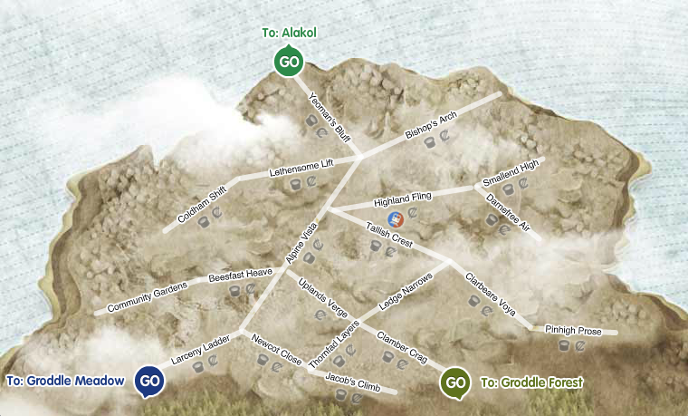
Groddle_Heights_Map.png (760 × 459 pixels, file size: 687 KB, MIME type: image/png)
Groddle Heights map on March 10th 2011.
File history
Click on a date/time to view the file as it appeared at that time.
| Date/Time | Thumbnail | Dimensions | User | Comment | |
|---|---|---|---|---|---|
| current | 08:29, 22 May 2019 | | 760 × 459 (687 KB) | Mndarrr (talk | contribs) | |
| 08:24, 22 May 2019 | 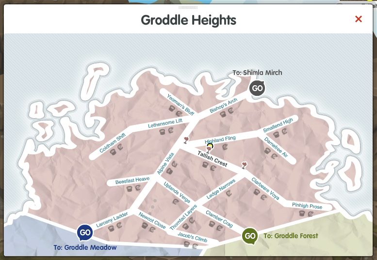 | 777 × 537 (320 KB) | Mndarrr (talk | contribs) | image of Groddle Heights region in early alpha |
You cannot overwrite this file.
File usage
The following page uses this file: