File:Groddle Forest Map.png
Jump to navigation
Jump to search

No higher resolution available.
Groddle_Forest_Map.png (759 × 459 pixels, file size: 886 KB, MIME type: image/png)
Licensing
This file is in the public domain, probably because it's from Glitch. Tiny Speck released Glitch's library of art assets for everyone to use:
- All files are provided by Tiny Speck under the Creative Commons CC0 1.0 Universal License. This is a broadly permissive "No Rights Reserved" license — you may do what you please with what we've provided. Our intention is to dedicate these works to the public domain and make them freely available to all, without restriction.
File history
Click on a date/time to view the file as it appeared at that time.
| Date/Time | Thumbnail | Dimensions | User | Comment | |
|---|---|---|---|---|---|
| current | 09:05, 22 May 2019 | | 759 × 459 (886 KB) | Mndarrr (talk | contribs) | map for Groddle Forest region |
| 09:04, 22 May 2019 | 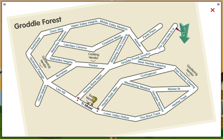 | 775 × 485 (161 KB) | Mndarrr (talk | contribs) | old version of groddle forest map from early alpha | |
| 06:26, 20 February 2011 | 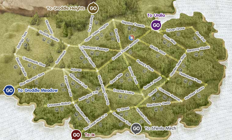 | 771 × 531 (468 KB) | Hburger (talk | contribs) |
You cannot overwrite this file.
File usage
The following 22 pages use this file:
- Adanac
- Addingfoot Trip
- Addysshot Croft
- Balcam Stacks
- Berecroy Woods
- Blackberry Glebe
- Blue Mountain Bore
- Burnabee
- Camsteeple Strat
- Cranbury Coppice
- Doon Way
- Evanfell Craine
- Fairgower Lane
- Fern End
- Ferncaster End
- Follybottom Stritt
- GFJ Subway Station
- Grand Mile
- Grimssea Bottom
- Grimssea Hollow
- Groddle Forest
- Groddle Forest Junction